Uppsala Maps and Orientation
(Uppsala, Uppsala County, Sweden)
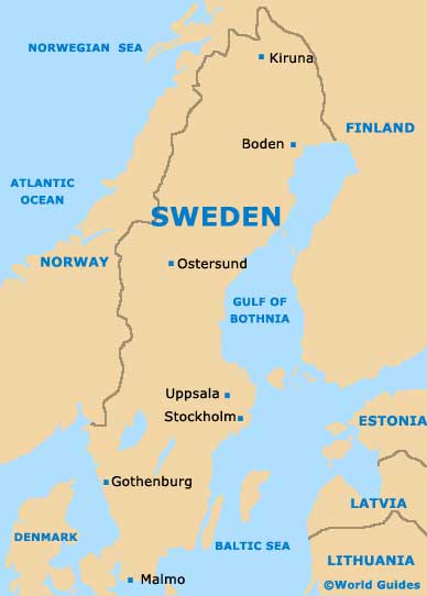
Situated directly north of
Stockholm and close to Sweden's easterly coast, Uppsala is known for being the country's important ecclesiastical centre. The city itself lies within the Uppsala County and is the fourth-biggest city within the whole of Sweden, featuring a population of around 130,000 people.
Many locals choose to commute to nearby Stockholm, which can be reached by rail travel in less than 45 minutes and this city is also regularly visited with tourists basing themselves within the city of Uppsala.
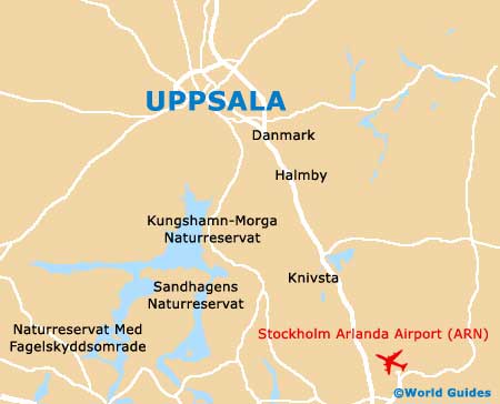
Maps and Orientation of the City
Central Uppsala is generally quite compact and easy to find your way around. A wide selection of historic buildings are based on the outskirts of the city centre, particularly in the region of the cathedral and the westerly banks of the River Fyris (Fyrisan).
The river itself splits the city of Uppsala into two main regions. The historic quarter lies on the western side, while the main commercial and residential districts are to be found to the east. For maps of Uppsala, try the bookstores on the Dragarbrunnsgatan, the Sankt Persgatan and at the train station, or the tourist office on the Fyristorg.
- Eskilstuna - 111 km / 68 miles (one hour and 40 minutes, south-west)
- Falun - 195 km / 121 miles (two hours and 30 minutes, north-west)
- Gävle - 110 km / 68 miles (one hour and 25 minutes, north)
- Haninge - 90 km / 56 miles (one hour and 20 minutes, south)
- Huddinge - 84 km / 52 miles (one hour and 15 minutes, south)
- Linköping - 265 km / 164 miles (three hours and ten minutes, south-west)
- Norrtälje - 72 km / 45 miles (one hour and ten minutes, north-east)
- Nyköping - 168 km / 104 miles (two hours, south-west)
- Orebro - 170 km / 105 miles (two hours and 20 minutes, south-west)
- Osthammar - 67 km / 41 miles (one hour, north-east)
- Södertälje - 100 km / 62 miles (one hour and 25 minutes, south)
- Stockholm - 69 km / 43 miles (55 minutes, south)
- Tierp - 63 km / 39 miles (50 minutes, north)
- Västeras - 78 km / 48 miles (one hour and ten minutes, south-west)
Map of Sweden
Map of Uppsala